The Big Thompson Canyon is an ever changing landscape. Rock falls, floods, and human development have dramatically changed the canyon in the last hundred years. So many landmarks that were once printed on postcards and maps have been lost or forgotten.
Pillars of Hercules
The Pillars of Hercules are found across the river on the first curve in the narrows. They were famous for being such an extreme example of upturned, nearly vertical, strata right at the entrance of the canyon, and are still sometimes marked on current topographic maps.
Unfortunately as US 34 became modernized into a highway the ability to park near this formation became dangerous and so viewing it can only really be done for a few seconds as you drive out of the canyon.
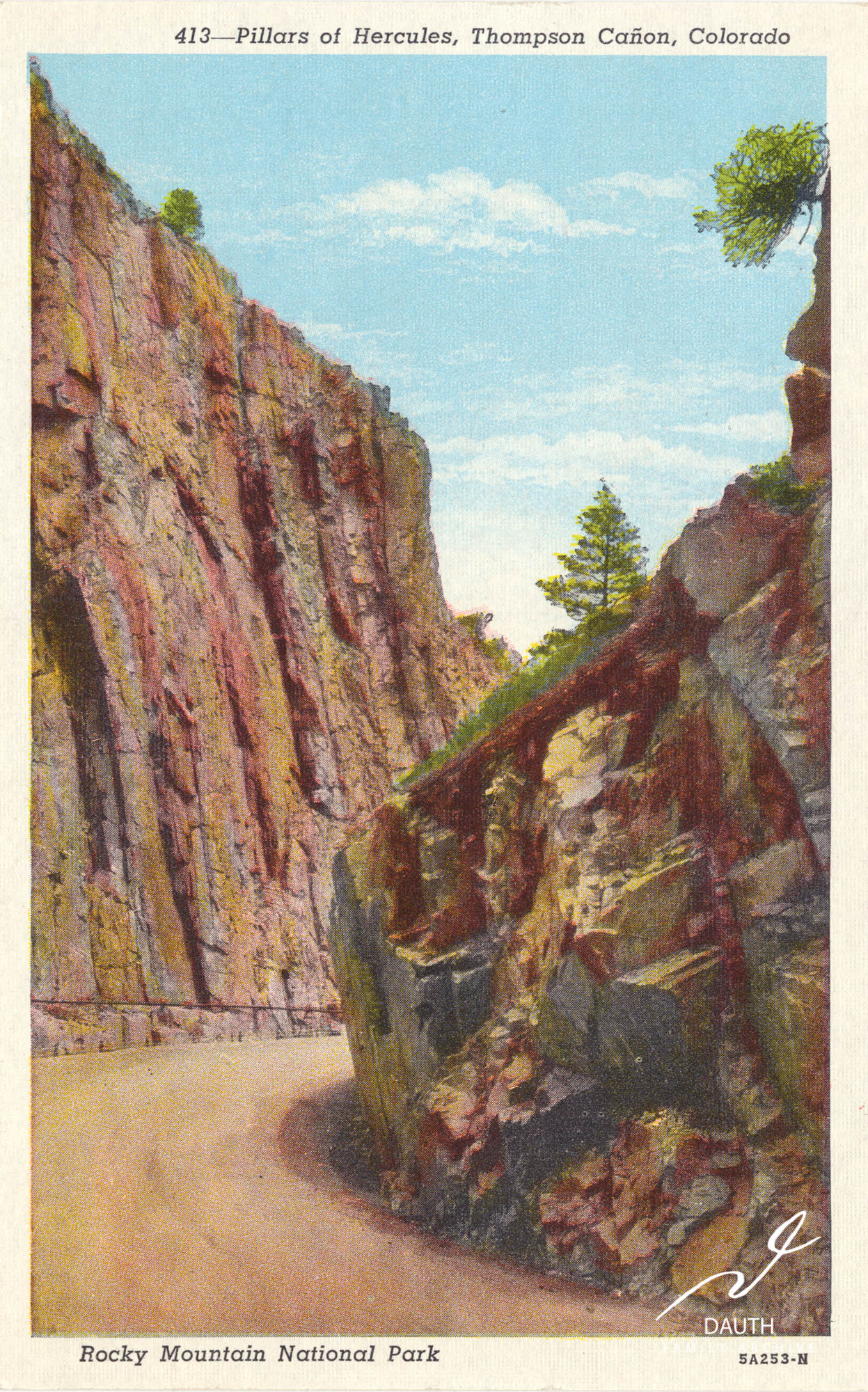
Colorized postcard of the Pillars of Hercules. The image is improperly colorized, and does not show the unique white granite pillar within this formation that contrasts against the gray surrounding rocks.
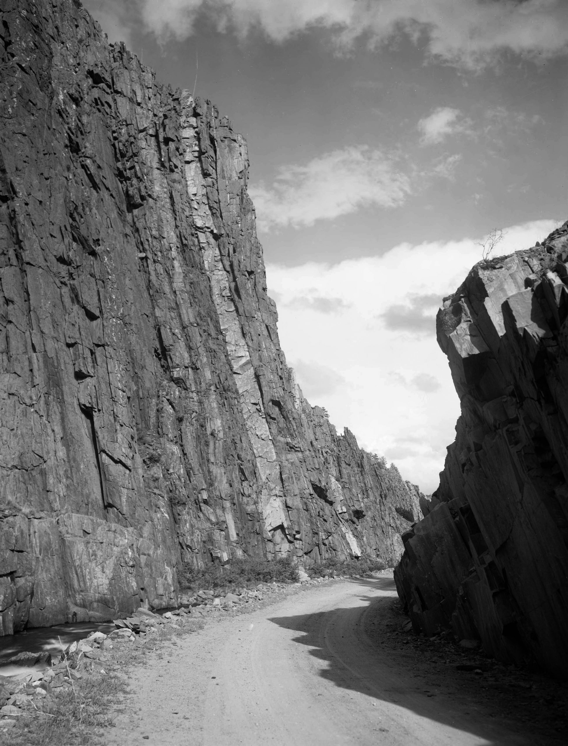
A black and white photo of the Pillars of Hercules that better shows the white granite pillar that contrasts against the surrounding grey rocks.1“Pillars of Hercules.” Denver Public Library: Digital Collections. 2021. 23 Mar 2021.
Witches Curve
Witches Curve is located at the western end of the narrows right before the canyon opens up to the community of Cedar Cove. This stretch of road earned its name in 1925 when Pierce Egan published his novel “Namaqua.”
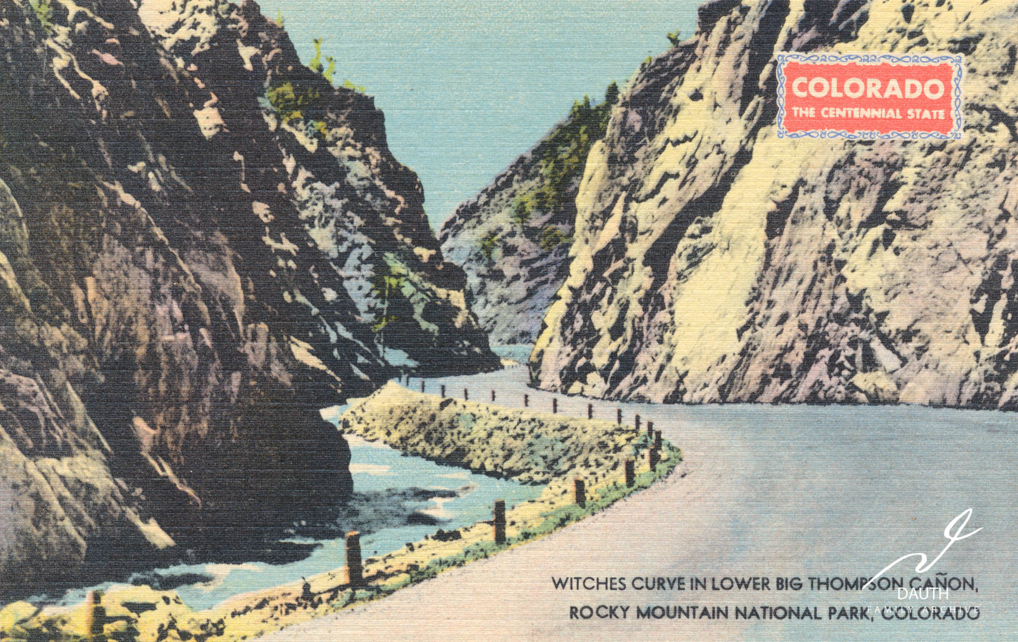
Witches Curve, named after a rock formation that has the profile of a witch. The rock formation is too small to be seen on the above postcard.
In this fictitious tale the villain of the story, Dan Delaney, comes home from college to find out that his highschool sweetheart, Sally Burch, married his best friend, Thomas Lee. In a fit of rage he kills Thomas which indirectly leads to the death of Sally in childbirth. Unbeknownst to him the newborn daughter, fittingly named Sally Lee, survives. Dan flees out west finding refuge in the Big Thompson Canyon, where he starts a murderous bandit gang.2Egan, Pierce. Namaqua, 1925.
Many years later in the 1880s, the orphaned Sally Lee coincidentally finds herself in the Big Thompson valley with an artist friend, Jack Salisbury. One day the two get lost in the narrows of the Big Thompson and Jack decides to paint Sally’s likeness on the canyon wall. Dan Delaney encounters the painting, and is enraged by the striking resemblance to that of his old sweetheart, and so he orders his men to blow up the painted rock face with a powder keg. The explosion destroyed the painting, but at the same time loosened rocks higher up on the mountain which “carved the likeness of a face, a terrible outline of a witch – the countenance of a devil.”3Egan, Pierce. Namaqua, 1925.
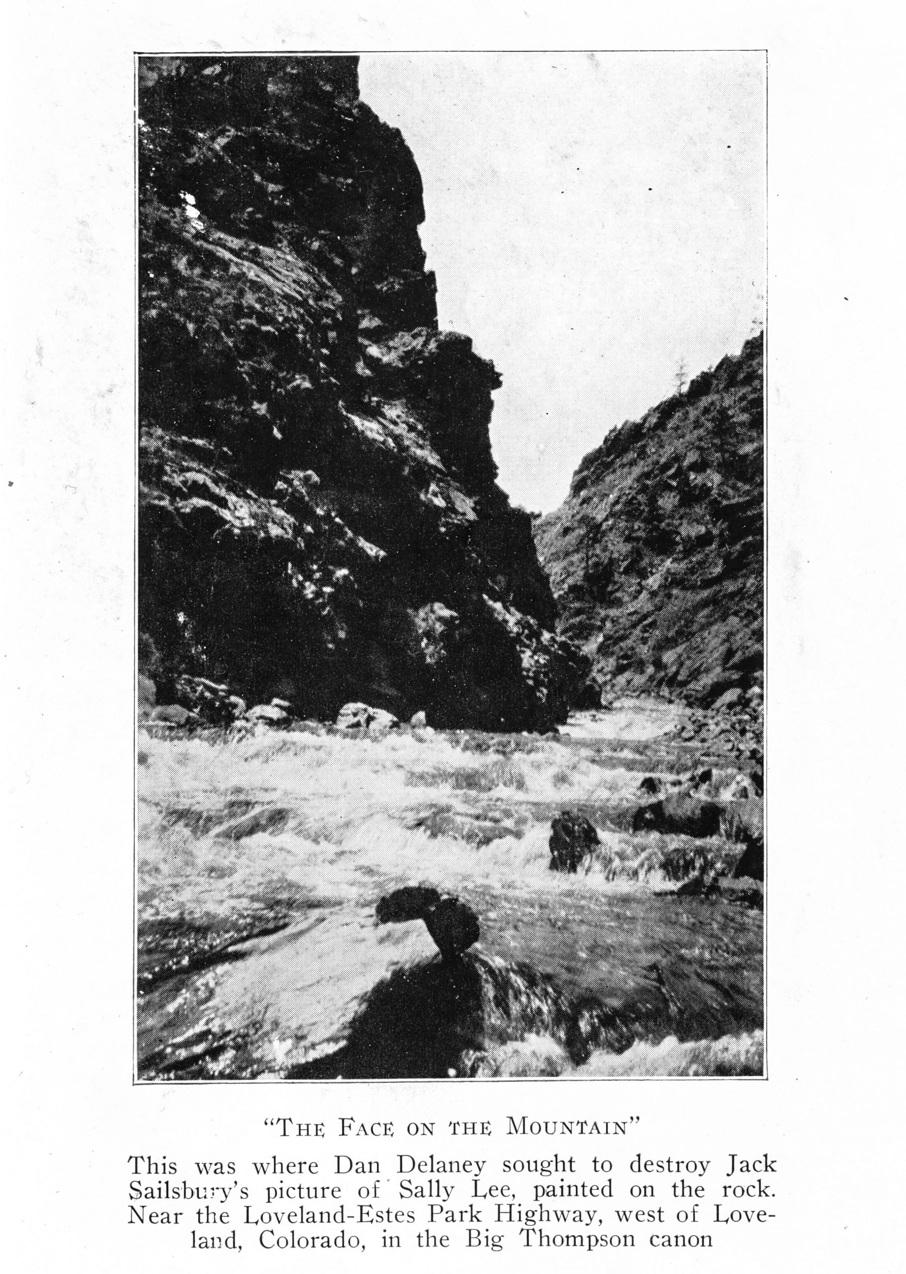
The silhouette of the witch’s face as depicted in the 1925 publication of Pierce Egan’s “Namaqua.” This rock formation is still clearly present today.4Egan, Pierce. Namaqua, 1925 p190
Sentinel Rocks
“As one comes along the road these imposing rocks meet the view, and stand like sentinels on watch over the magnificent scenery.” The Sentinel rocks were located on the first curve west of Drake towards Estes Park. They were demolished in the 1930s to make way for US 34 and improve the safety of the road.
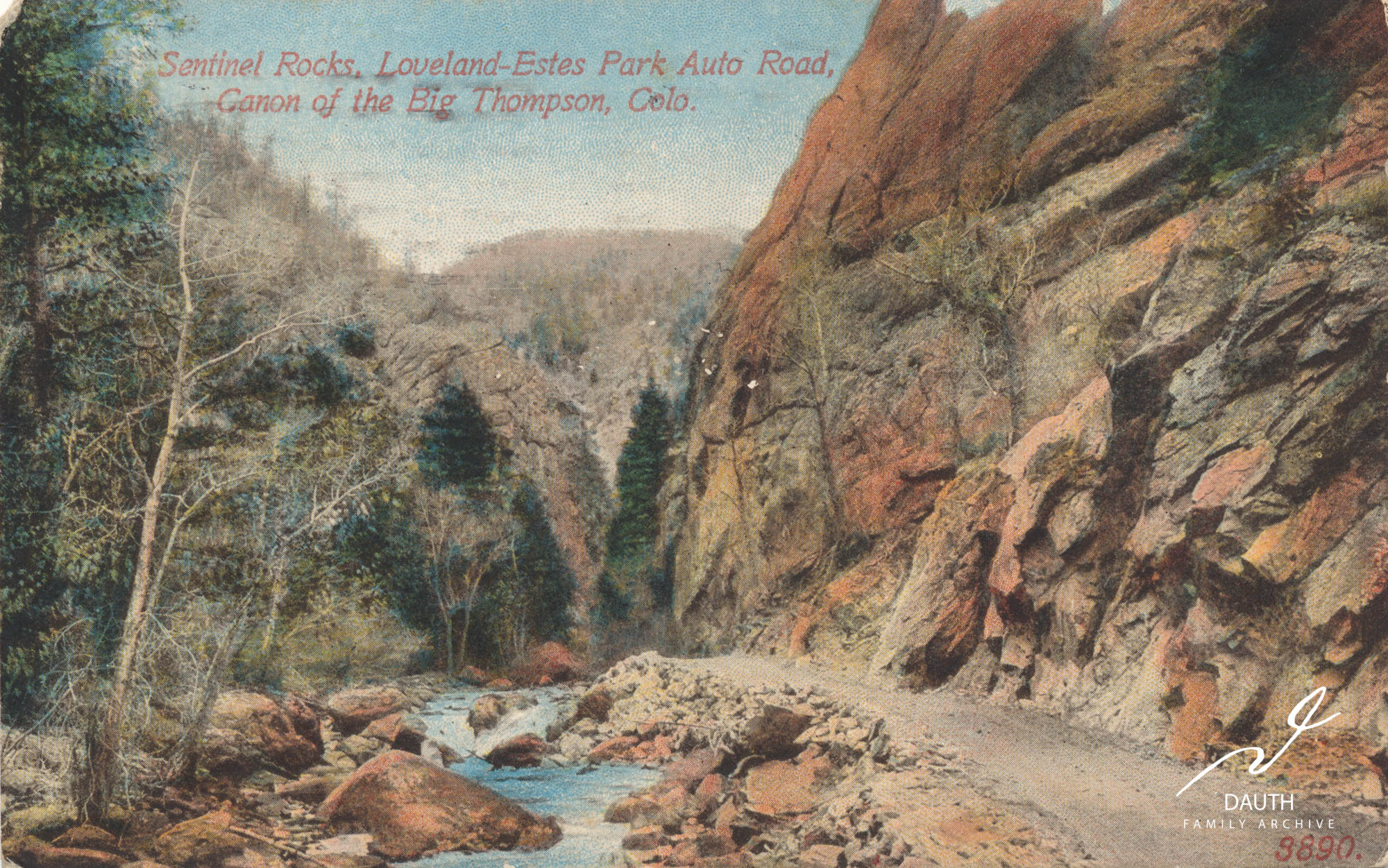
Postcard of the Sentinel Rocks c. 1913 based on rear postscript.
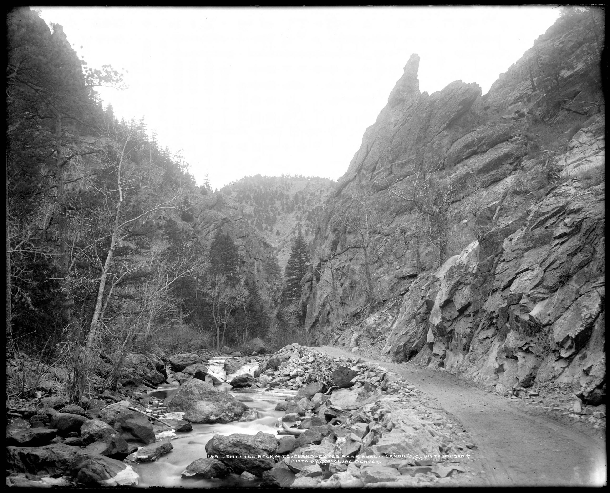
This photograph of the Sentinel Rocks shows the characteristic pinnacle not visible in the cropped postcard.5“Sentinel Rock.” Denver Public Library: Digital Collections. 2021. 23 Mar 2021.
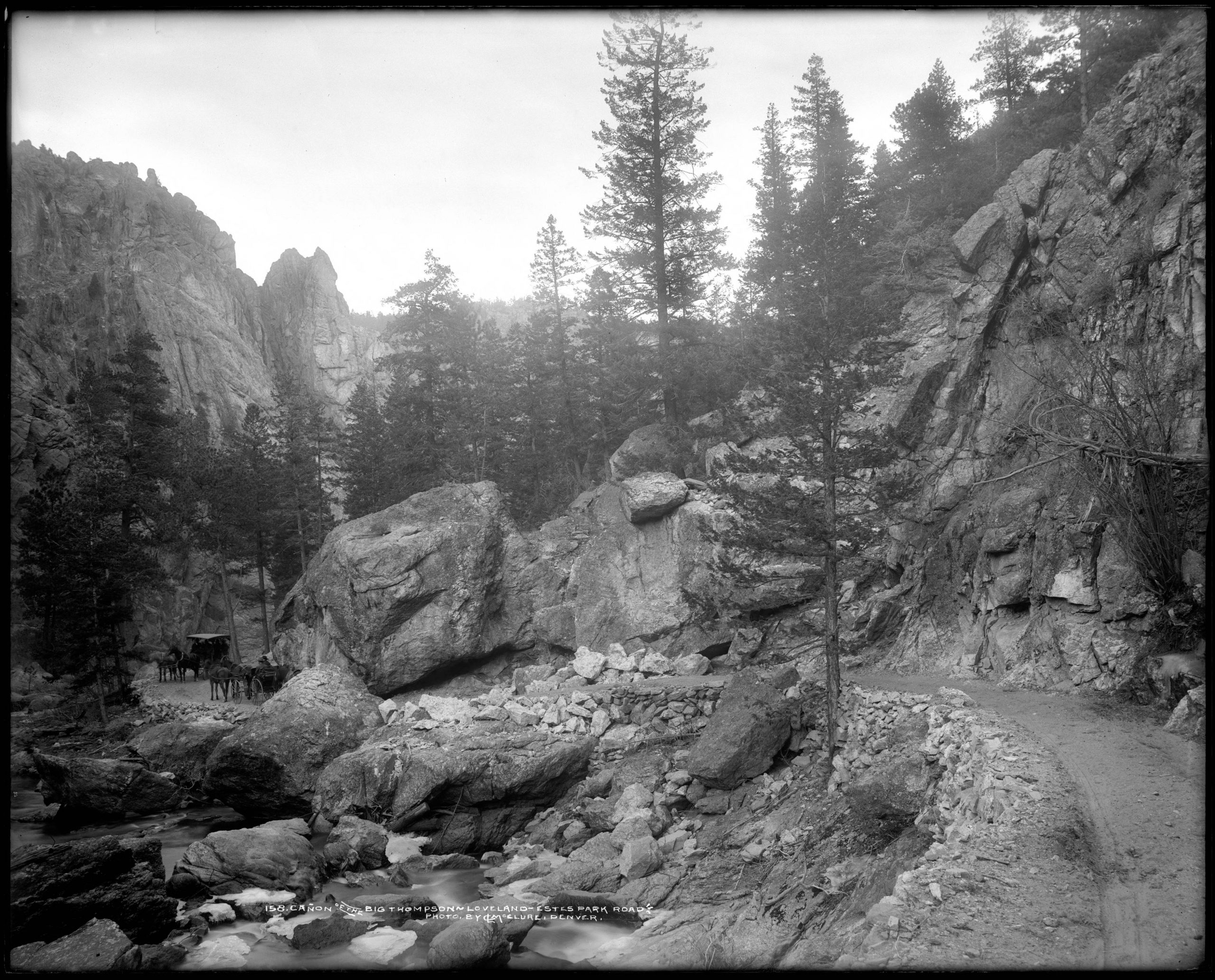
Sheep's Head Rock
Sheep’s Head Rock was part of the Sentinel Rock formation, located on the first curve west of Drake towards Estes Park. Also known as hanging rock, this rock formation had the characteristic profile of a sheep. Its unique undercut by the Riley Road made it a popular photography spot.
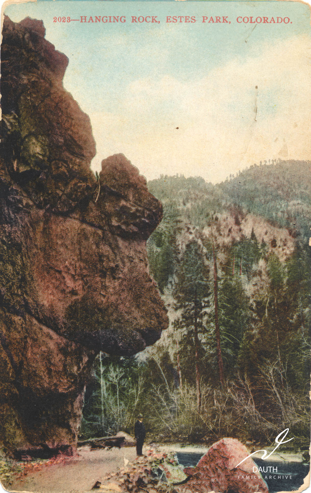
Postcard using the “Hanging Rock” name for Sheep’s Head Rock. Dated to 1913.
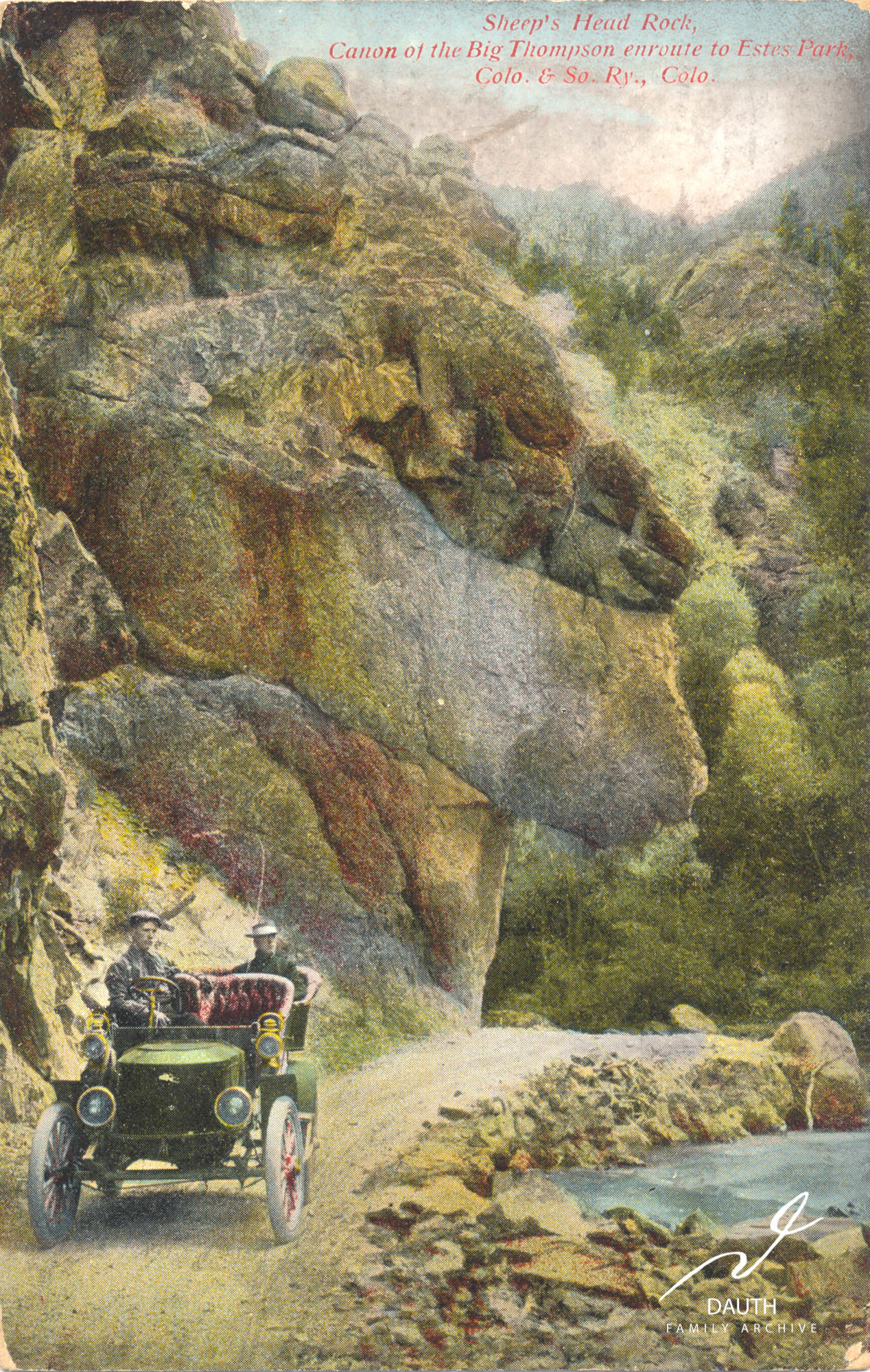
Colorized postcard of Sheep’s Head Rock. Rear postscript is from 1909.
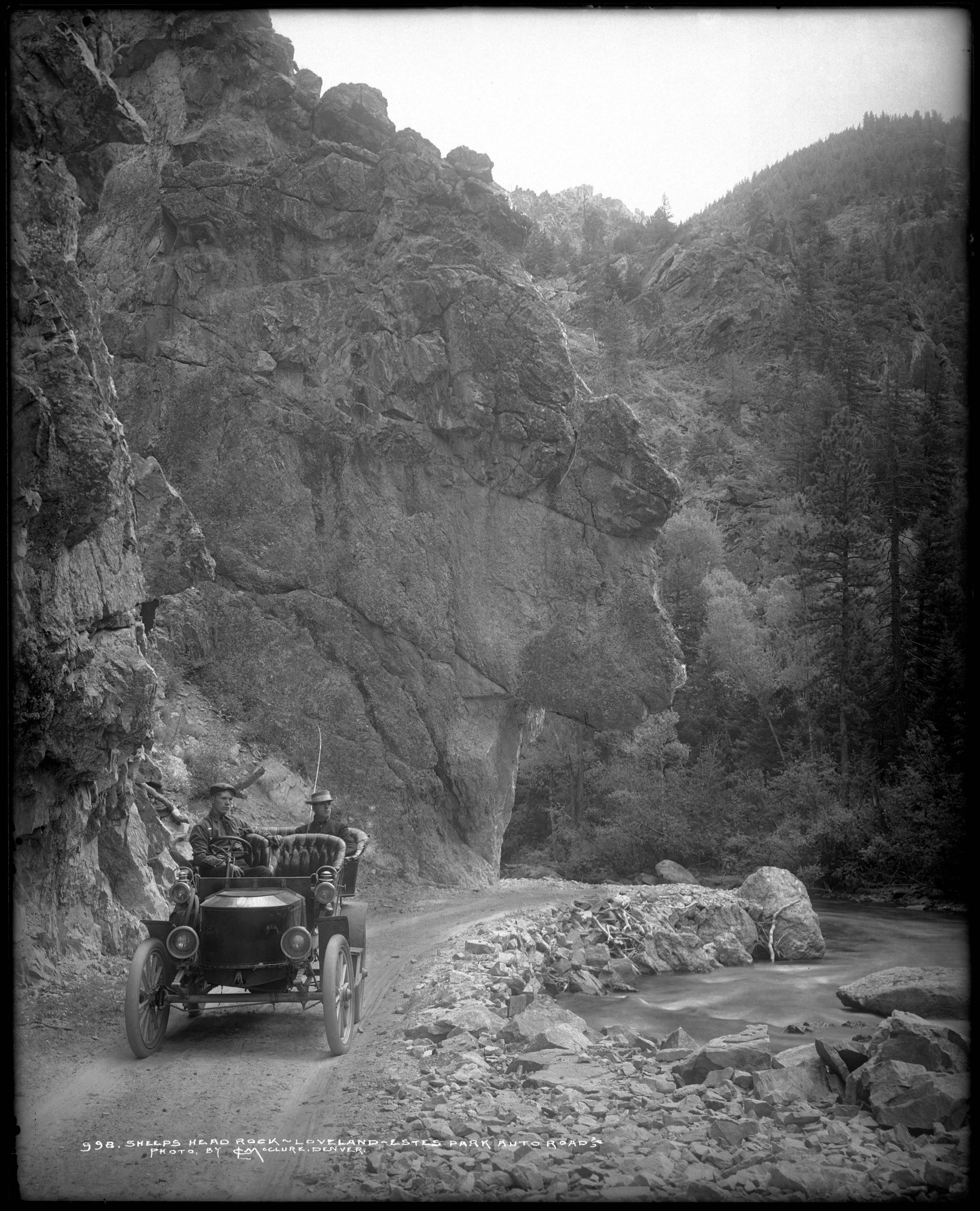
A black and white photo of Sheep’s Head Rock. Notice how this photo was the reference photo for the above postcard.6“Sheep’s Head Rock.” Denver Public Library: Digital Collections. 2022. 22 Apr 2022.
Devils Curve
Devils Curve was located after the the first bend west of present day Waltonia. This curve was famous for being a treacherously tight turn, that was in frame with Pinnacle Rock (the larger rock pillar colorized in red in the postcard below). This area was sometimes referred to as “Point Majestic.”
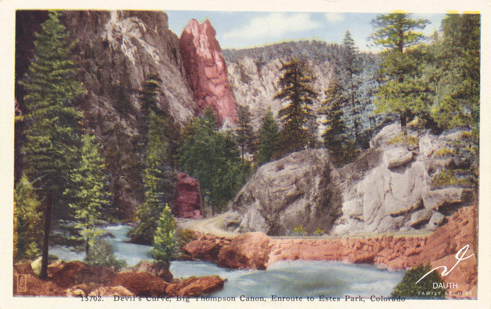
Colorized postcard of Devil’s Curve.
The roadway depicted was the Riley Road built in 1905 which would be replaced in 1937 with US 34 on the opposite side of the river. This curve no longer exists possibly due to erosion from the past floods and construction to widen the riverbed. Pinnacle Rock in the background still stands tall today.
A photograph of Devils Curve showing two horse drawn wagons passing along the curve.7“Devils Curve.” Denver Public Library: Digital Collections. 2021. 23 Mar 2021.
Eagle Rock
Eagle Rock was located across the street from 2288 US Highway 34. This once prominent rock pillar, has since eroded away leaving little resemblance to its photographs. It became famous and earned its name because eagles would nest there. Milo Osborn, one of Lovelands first settlers, lived across from Eagle Rock in the 1910s.
…so right across the river, which is in front of the cabin, there’s a big rock that we call “Eagle Rock.” And there are pictures of that. You’ll find them occasionally in books, post cards and so forth of Eagle Rock. There was a big eagle nest right up on the top. You know how they do. They build right on top of a cliff with sticks this long and this big and that’s where the little eaglets be out there on the edge. But that’s Eagle Rock. Right across from the cabin.
Milo Allee Osborn, Oral History Transcript, Fort Collins History Connection
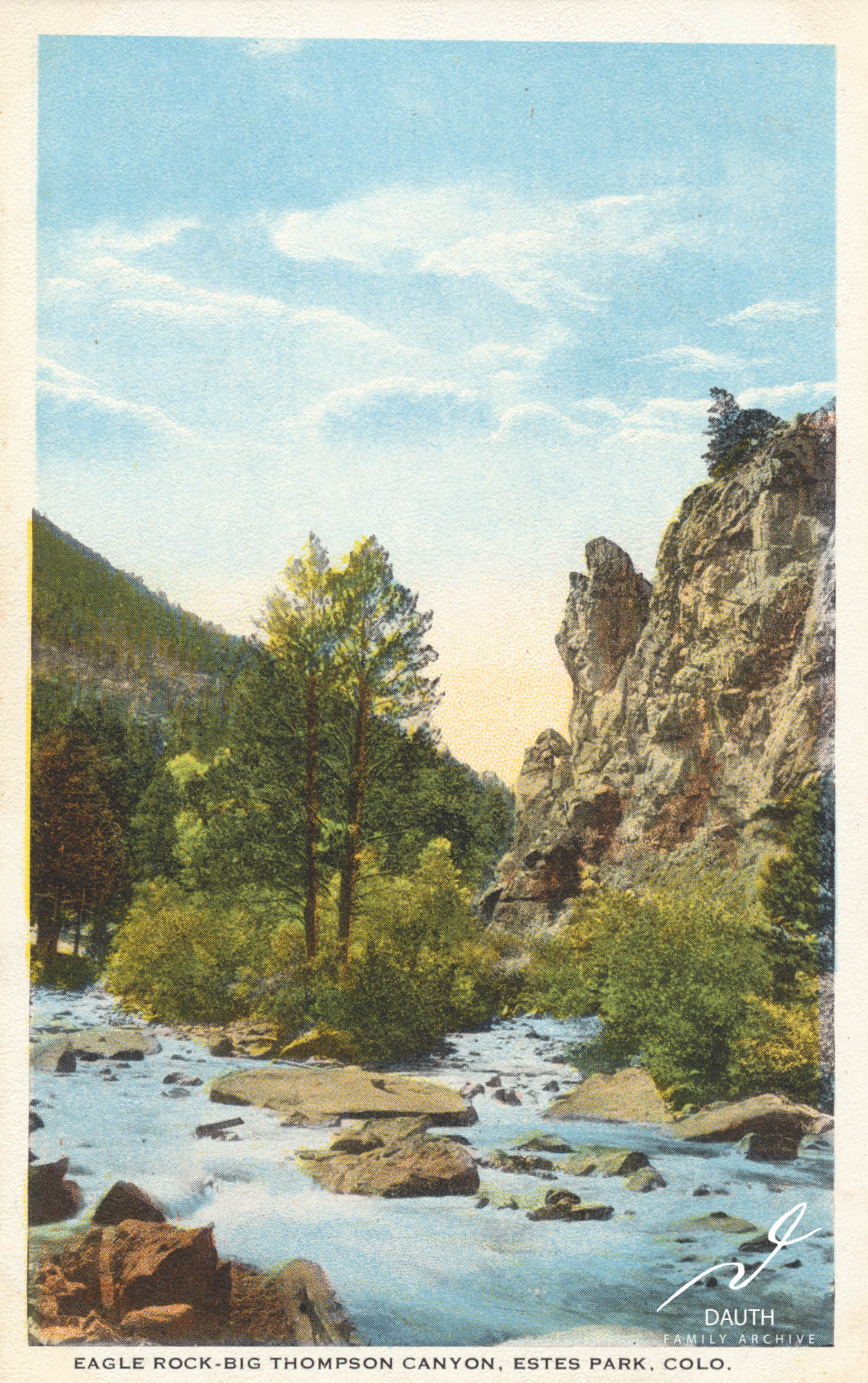
Colorized postcard looking west towards Eagle Rock.
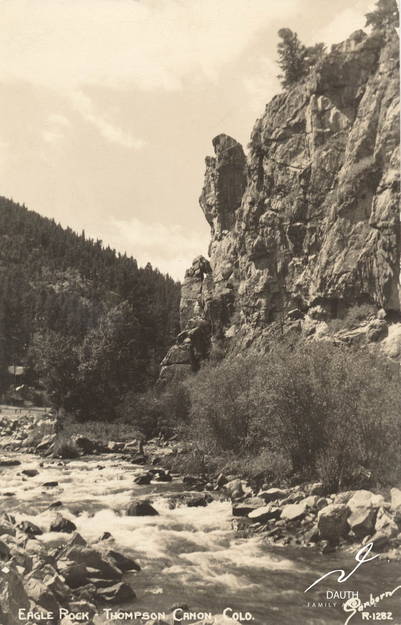
Black and white photo postcard of Eagle Rock.
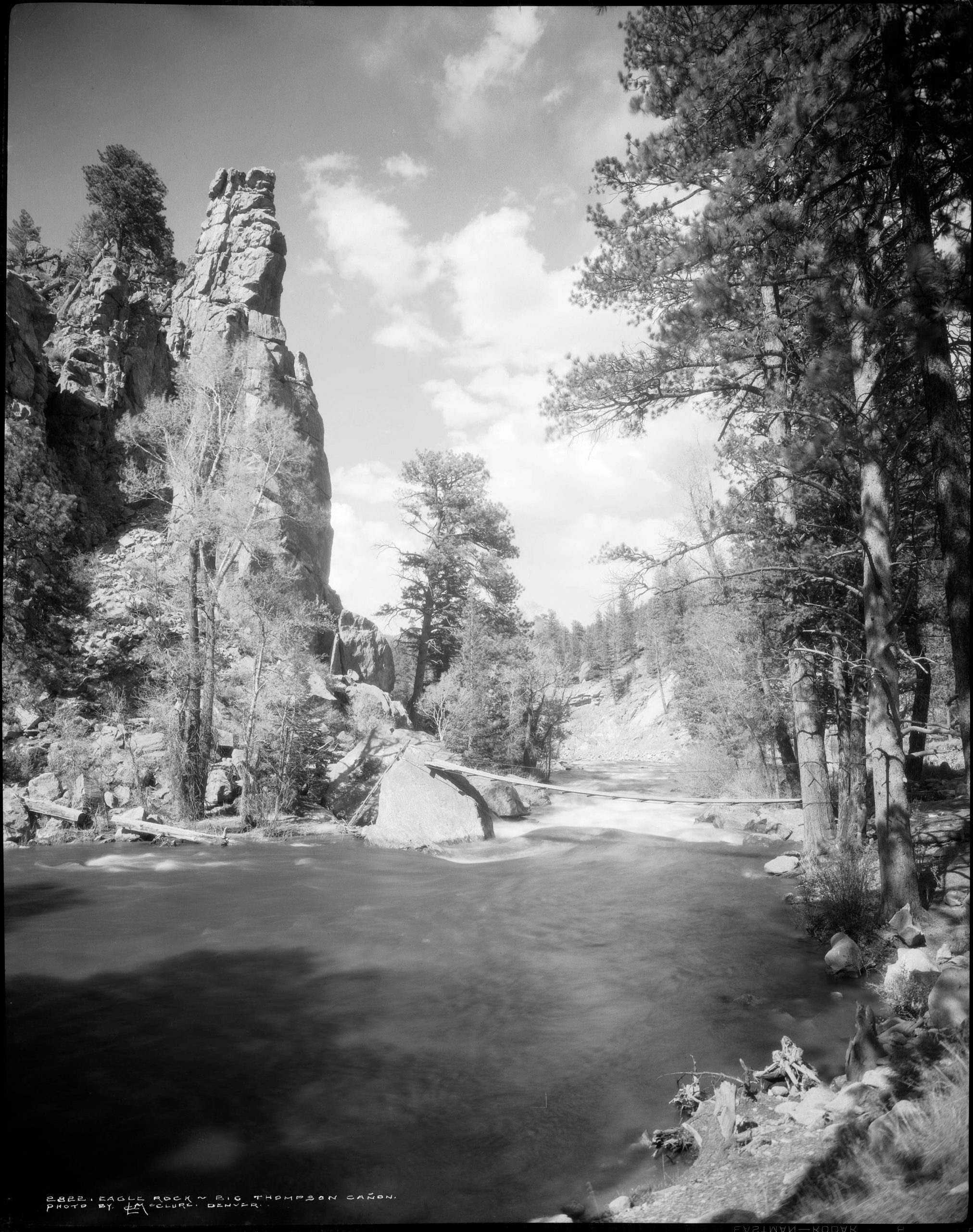
This photograph shows the other side of Eagle Rock looking east. A small footbridge is visible that allowed people to cross over from the roadway.8“Eagle Rock.” Denver Public Library: Digital Collections. 2021. 23 Mar 2021.
- “Pillars of Hercules.” Denver Public Library: Digital Collections. 2021. 23 Mar 2021.
- Egan, Pierce. Namaqua, 1925.
- “Sentinel Rock.” Denver Public Library: Digital Collections. 2021. 23 Mar 2021.
- “Devils Curve.” Denver Public Library: Digital Collections. 2021. 23 Mar 2021.
- “Eagle Rock.” Denver Public Library: Digital Collections. 2021. 23 Mar 2021.