The Idlewild Sub-division plat was filed by Ella Van Bramer on August 9th 1910. The plat document officially named the area “IDLE WILD” and divided Ella’s land claims into twenty-two 100ft wide lots. A map included with the plat shows property lines as well as a variety of structural landmarks providing an interesting snapshot of how Idlewild looked at the time.
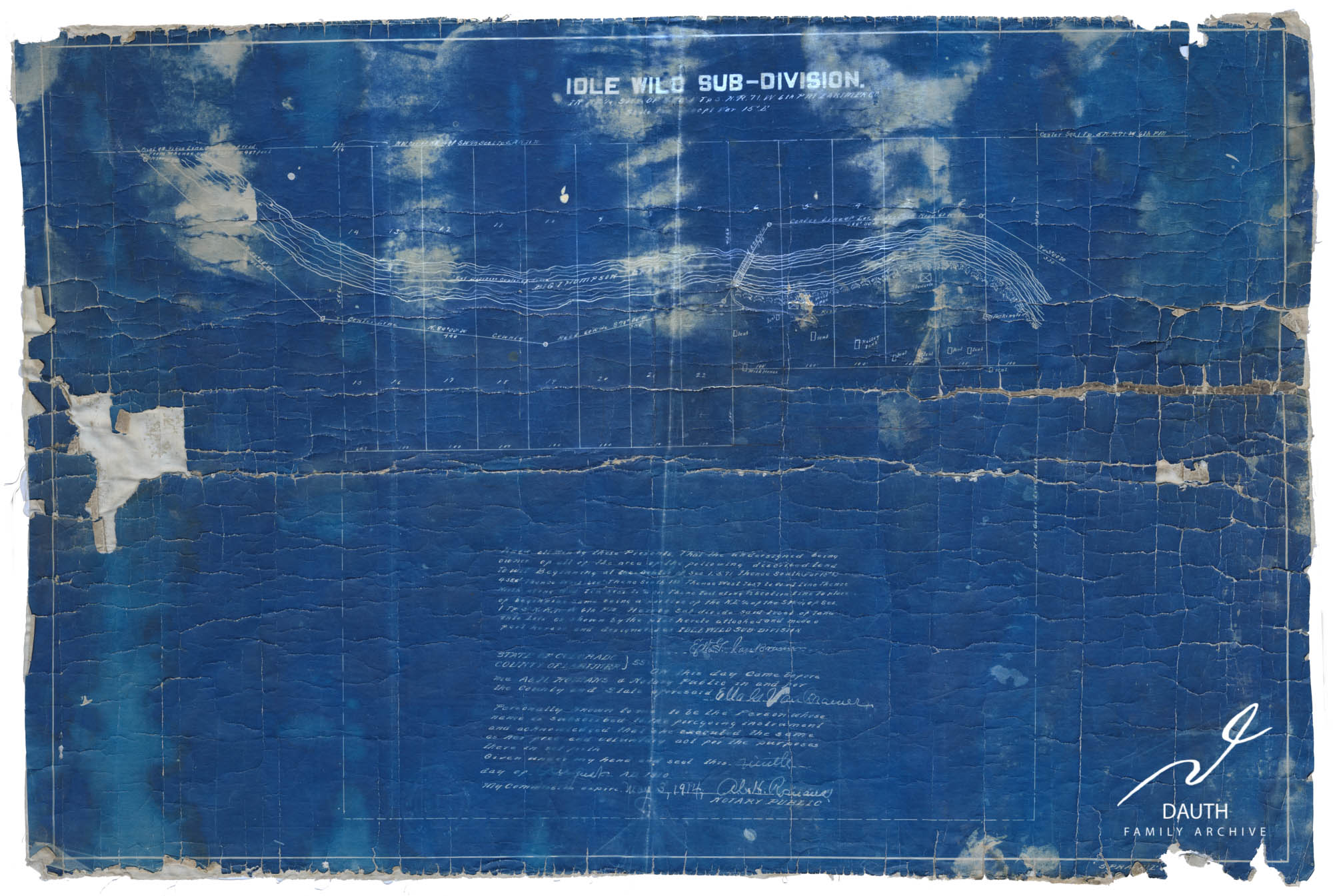
IDLE WILD Sub-division Plat, August 9th 1910.11910-08-09 – Idlewild Subdivision Blueprint Plat
Idlewild Bridge
In 1910 the Riley Road, labeled on the plat blueprints as “County Road”, crossed the Big Thompson river at the present day Idlewild Lane bridge. The bridge crossed at an angle back then to allow the Estes Park traffic to cross the river without stopping.
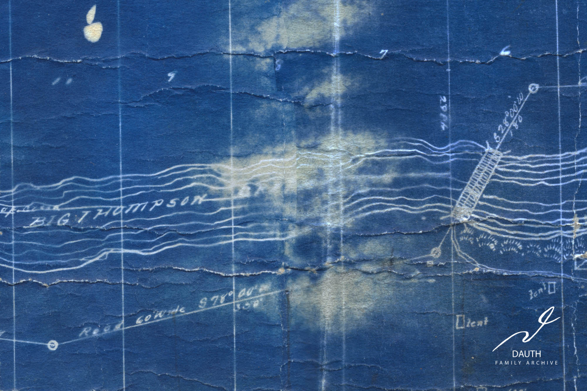
Idlewild bridge and the “County Road”, informally known as the Riley Road. Notice that there is no road north of the Big Thompson west of the bridge.2Circa 1920 – Idlewild Bridge
It wasn’t until 1920 that the road west of the bridge was moved to its present day location on the northern side of the river.
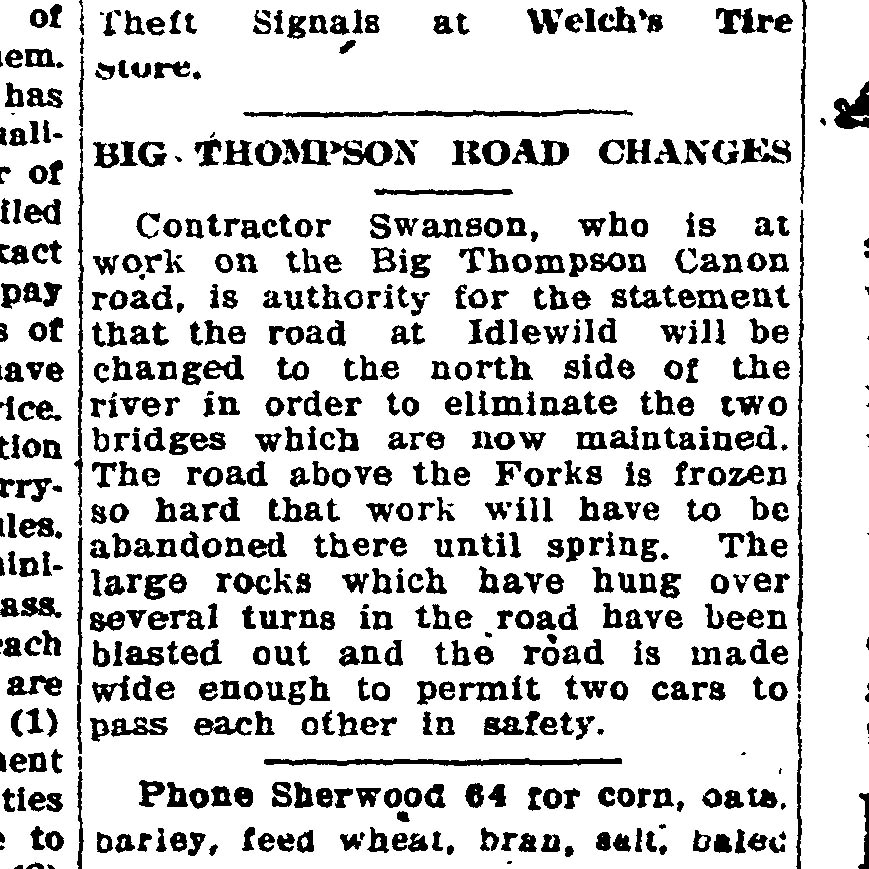
BIG THOMPSON ROAD CHANGES
Contractor Swanson, who is at work on the Big Thompson Canon road, is authority for the statement that the road at Idlewild will be changed to the north side of the river in order to eliminate the two bridges which are now maintained. The road above the Forks is frozen so hard that work will have to be abandoned there until spring. The Large rocks which have hung over several turns in the road have been blasted out and the road is made wide enough to permit two cars to pass each other in safety.31920-01-05 – Fort Collins Courier – Idlewild Road Moved
Fort Collins Courier – January 5, 1920
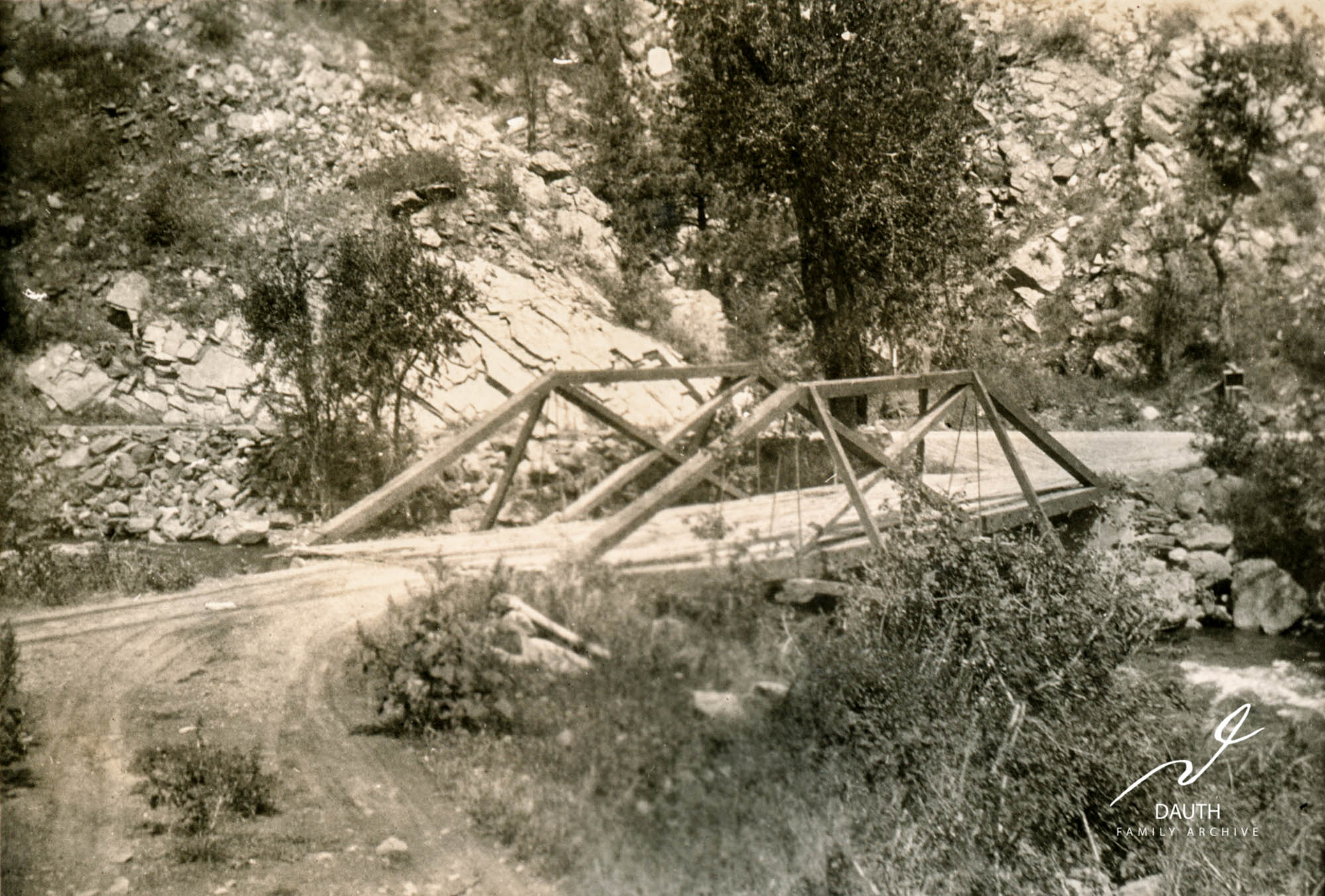
Looking north at Idlewild bridge, with the new county road across the river heading west. Estes Park bound visitors from Loveland crossed Idlewild bridge and then recrossed a second bridge further upriver prior to 1920. Photo taken c. 1920.4Circa 1920 – Idlewild Bridge
Idlewild Resort
The plat shows that Ella Van Bramer’s resort was located east of the Idlewild bridge on the southern side of the Big Thompson river within lots 1-6.
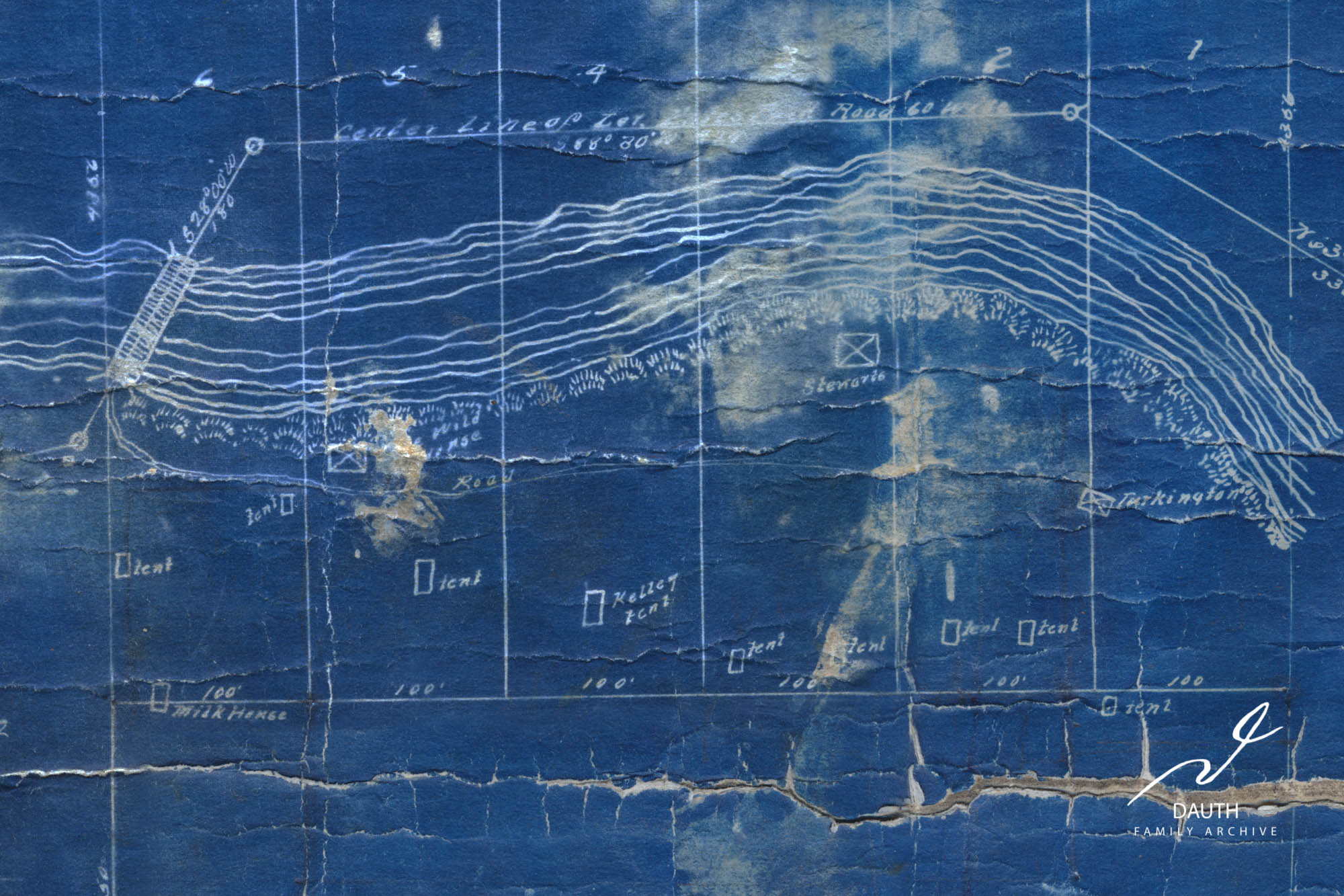
Plat closeup of Idlewild resort which encompasses the southern halves of lots 1-6.
The resort guest house is labeled as the “Idle Wild House” and was located next to the road on present day lot 5.
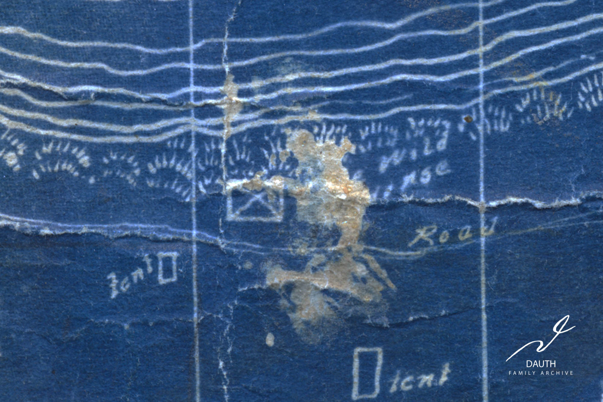
The “Idle Wild House” [name partly obscured by document damage] next to the resort road on Lot 5. This is where Ella Van Bramer would check in guests and serve food.
There are nine tent sites marked on the plat, all of which are south of the resort road. Most of the sites were built on hilly areas of the property with the exception of one tent site next to the guest house. One tent site on lot 4 is reserved for an individual named “Kelley.”
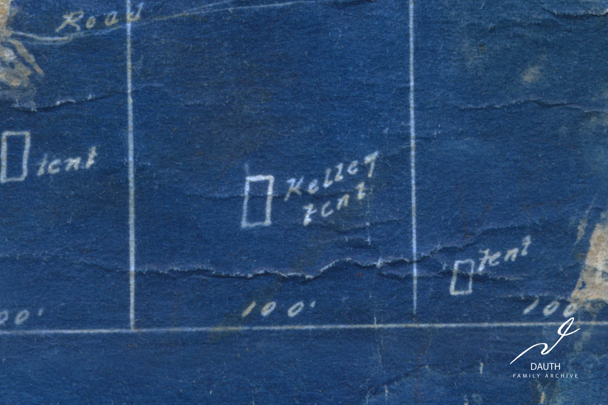
The Kelley tent that was located on the hill on Lot 4.
A milk house, which was used to store food and perishables, was built over the small creek near the bridge on lot 6. At some point Ella wanted to start a dairy business and was producing butter at Idlewild.51906-04-12 – Loveland Reporter – Ella Van Bramer Planning Dairy Business61906-07-12 – Loveland Reporter – 1906 Big Thompson Flood It’s possible this milk house had a connection to that venture.
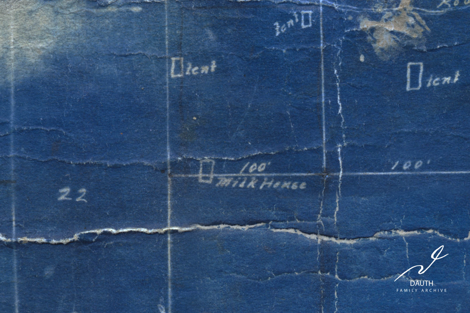
The milkhouse located on the creek that runs through the valley across from Idlewild Lane bridge.
Two cabins were also found in the resort. One owned by Turkington stood between lots 1 and 2 at the end of the campground road, and the other owned by Stewart stood at the present location of the Idlewild Lodge.
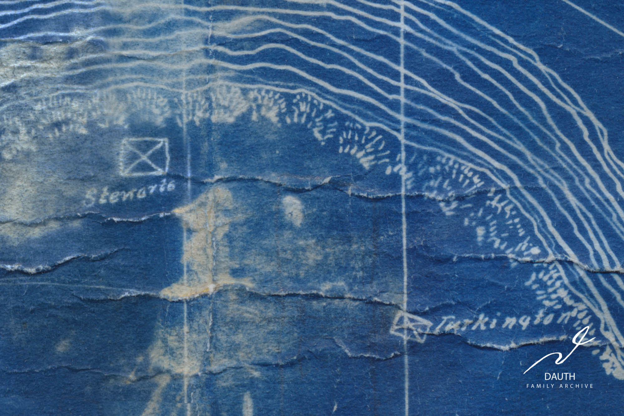
The cabins owned by Stewart and Turkington.
MLA Format
Idlewild Lodge. "IDLE WILD Subdivision Plat." Idlewild Lodge, Dauth Family Archive, 31 Mar. 2021, https://idlewildlodge.github.io/idle-wild-subdivision-plat/. Accessed 4 Jul. 2023.
⧉
APA Format
Idlewild Lodge. (2021, March 31) IDLE WILD Subdivision Plat. Retrieved July 4, 2023, from https://idlewildlodge.github.io/idle-wild-subdivision-plat/.
⧉
Chicago Format
Idlewild Lodge. "IDLE WILD Subdivision Plat." Idlewild Lodge. Dauth Family Archive, March 31, 2021. Accessed July 4, 2023. https://idlewildlodge.github.io/idle-wild-subdivision-plat/.
⧉